| Pictures of Thistle, Utah |
| Courtesy of OnlineUtah.us (Links Added) |
|
|
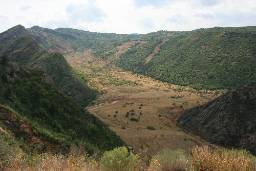
| Picture courtesy of Kathy M. Wiersdorf map |
| "Record-breaking precipitation in the fall of 1982, followed by a deep winter snow pack, then warm spring temperatures and rapid snowmelt in 1983 set the stage for the Thistle landslide. Once triggered, the slide reached a maximum speed of 3.5 feet per hour and dammed the Spanish Fork River within a few days." |
| By Mark Milligan |
|
|
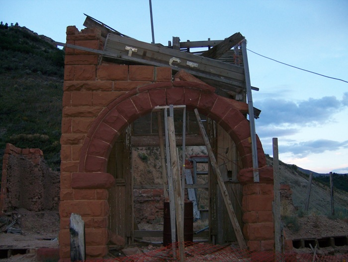
| Picture courtesy of Jenny Bauman |
| At 3.5 feet per hour movement of the earth, within five days the slide had created a 900 acre lake 2.5 miles long and 200 feet deep. Remnants of the old red brick school above. |
| Return to Thistle history | Return to Main Gallery | Current Thistle Weather |
| Pictures © Copyright 2021 OnlineUtah.com All rights reserved. |
|